|
The 2024 edition of the DKW Vaarkaart Nederland is now online! In this article we would like to tell you more about the new functions, which can be optimally used, especially in the 2024 edition of WinGPS 6.
Equipped with a current TOP10NL based on the most recent aerial photographs from the land registry, DKW Vaarkaart Nederland 2024 has been improved on a large number of points compared to the previous edition.
Optimized for CourseUp and HeadUp sailing.
Previous editions of DKW Vaarkaart Nederland were designed for sailing on a non-rotating north-oriented chart (in NorthUp or CharUp tracking mode). Ideal at sea and the large lakes. However, GPS-controlled sailing in CourseUp tracking mode is most commonly used on inland waterways. You will then always sail upwards on your screen. Left is port and right is starboard.
Almost all texts such as depth numbers have now been moved from the chart to the included waypoint database, which can be found as groups in the Waypoints menu. In CourseUp or HeadUp the chart rotates, but the texts always remain horizontal and therefore easy to read and not crooked or upside down. An advantage is also that you can turn off the relevant waypoint groups for areas that you do not visit, such as the large waypoint group of the Wadden Sea. This makes the image refresh faster and the chart image clearer.
More recent depths of the Frisian Lakes
Using newly developed software, the most recent data series with multibeam measurements from the Province of Fryslân have been processed into a waypoint database for DKW Vaarkaart Nederland 2024. The soundings represent the shallowest places within a circle with a radius of 160m with depths relative to the Fries Boezem Peil. The depth lines are still unchanged compared to 2023.
Sector and lighthouse lights as a waypoint group.
For the 2024 edition we managed to draw the sector lights and lighthouse lights in vector format on the chart in WinGPS 6-2024. Important for calls at ports at dusk and in the dark. This option is not supported in WinGPS 6-2023.
New depth image of the Wadden Sea.
The new depth image of the Wadden Sea is based on the most recent and detailed depth image of IENC Waddenzee from RWS (Rijkswaterstaat). Previous editions were based on the approximately 6-year-old soil model in NAP from ZUNO (RWS), which is also used in Stentec Tidal (formerly Kustfijn).
The depths of the Wadden Sea and Zeeland are defined in relation to LAT (Lowest Astronomical Tide), just as in the DKW1800 series. Vaarkaart Nederland is therefore a safe chart for sailing on tidal waters. Both in Zeeland and on the Wadden, the soundings indicate the shallowest values within a circle with a radius of 320 m.
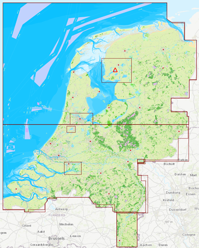
Classification of DKW Vaarkaart Nederland 2024 in images and in chart management
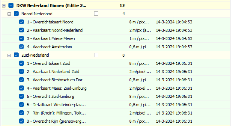
New: Detailed chart of Westeinderplassen, South Limburg and a separate border crossing at Lobith.
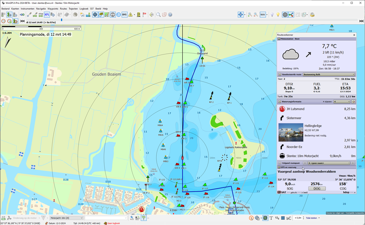
Vaarkaart Netherlands 2024 is optimized for CourseUp and HeadUP.
Here along a route from Heegerwal marina to Balk.
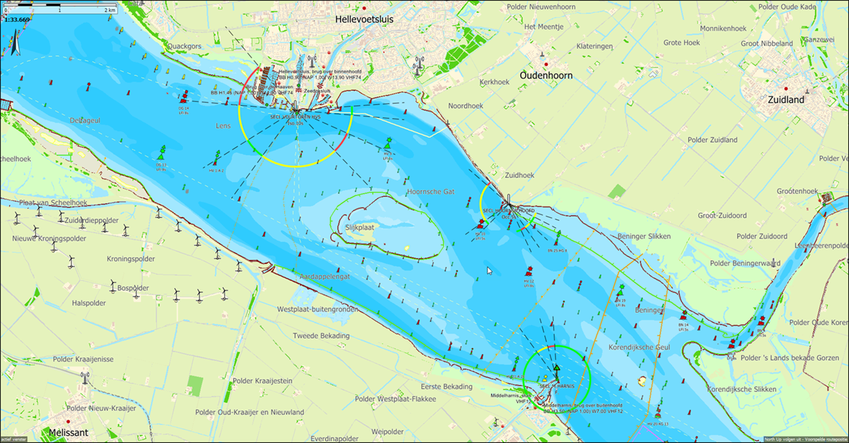
Sector lights in the Deltageul and the Hoornse gat. Only shown with WinGPS 6-2024 and subsequent versions.
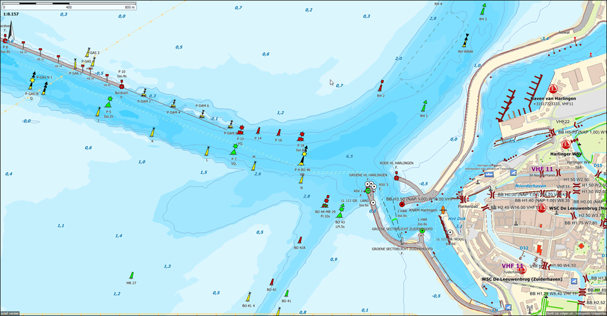
Recent depth image of the Wadden Sea near Harlingen based on IENC Wadden Sea (RWS Jan 2024).
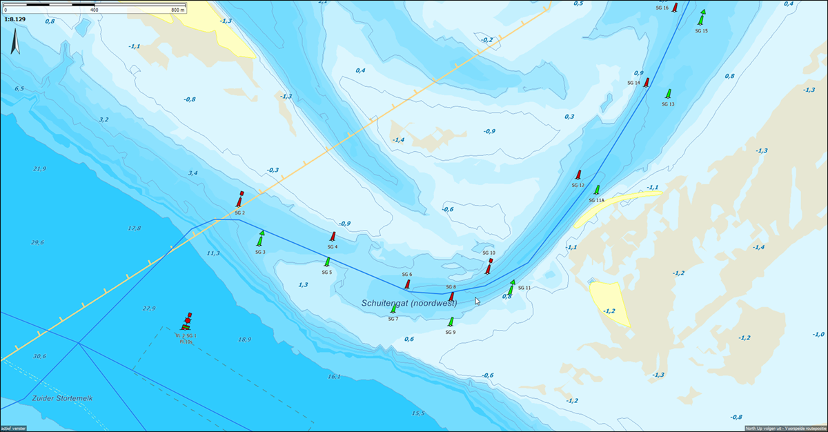
Detail of the changing Schuitengat in DKW Vaarkaart NL 2024.
Note that the current buoyage has already shifted again. The route network here has not yet been updated and still runs above the red SG8 instead of below it. The buoyage of Vaarkaart Nederland is updated weekly, but that of the chart is not. The Schuitengat of the Stentec IENC Updateservice for WinGPS 6 2024 does correspond with the current buoyage. The IENC depth image of the Wadden Sea and Zeeland is updated weekly. However, the concrete on site may differ and is of course always decisive.
Do you have any comments or feedback about this new chart? Then you can email this to helpdesk@stentec.com.
| 


