After the free app WinGPS Marine for iOS, Stentec releases the extended version WinGPS Marine Plus. This app included premium features and is developed for the iPhone and iPad.
With WinGPS Marine plus for iOS it is possible to wirelessly connect your AIS device. This way you can see the AIS objects on your chart.
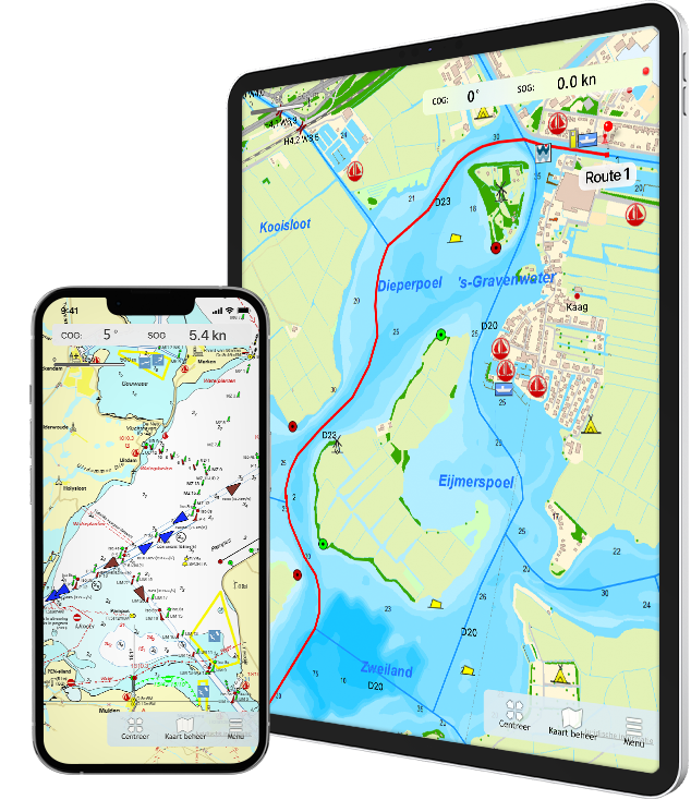
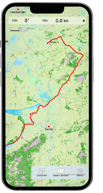
NEW - Plot a route with single points on open water, or plan the route over the waterway network taking into account the bridges, locks and restrictions of the waterways, and the dimensions of your ship.
Navigate the waypoints using the course line, Course to Steer and Distance to Go and view and save your route.
For inland waterways you can put the app in course-up mode.
Expected soon
Now that the route planning has been expanded by combining it with the waterway network, this will be optimized in the coming period. After this, we will add GRIB file downloads to WinGPS Marine Plus, for example to show wind and precipitation on the chart. The current and tide information is also planned for the development of WinGPS Marine Plus.
Charts
The charts that can be used in this app, are Stentec’s own DKW-charts. For example the free chart DKW Frisian Lakes or the well-known DKW 1800-series for the Dutch coastal waters, including weekly update services.
At the first start-up of the app, you will be asked to log in with your account. The free default online maps from Apple are available in the app for orientation. The DKW-charts, which are connected to your account, can be downloaded directly in this app and be used for navigation.
Note: only charts from 2018 and newer can be used in this app. Do you have older charts? Then you can renew them in our online shop. Click here to renew your cards >
System requirements
Storage space 58 MB of storage space for the app itself, but of course there must
also be sufficient storage space for your DKW charts.
iOS-version Minimum iOS 11.0
Note: WinGPS Marine Plus can be activated and used on 1 iPhone and 1 iPad. Family sharing is not possible.
WinGPS Marine for iOS can be used on devices with iOS 11.0 and newer.
If your device has an older iOS version, you can check in your system settings
if the operating system can be updated. When the operating system is up-to-date,
the following devices will be suited:
iPhone
iPhone 5S (2013)
iPhone 6 (2014)
iPhone 6 Plus (2014)
iPhone 6S (2015)
iPhone 6S Plus (2015)
And newer models.
iPad
iPad mini 2 (2013)
iPad Air (2013)
iPad mini 3 (2014)
iPad Air 2 (2014)
iPad mini 4 (2015)
iPad Pro 12.9 (2015)
And newer models.
iPod
iPod touch GEN 6 (2015)
And newer models.
Note: not every device mentioned above has a built-in GPS receiver. If your device does not have an internal GPS receiver, you can use a bluetooth GPS receiver
Let us know what you think In the coming period, the app will of course be further upgraded, optimized and new (possibly paid) features will be added, for example GRIB files, stream and tidal information and the option to connect other board instruments. We would like to continue to receive your feedback about the current version and any wishes for future versions via the feedback form.